
Japanese天橋立と宇治茶に見る京都府の広がり
Amanohashidate and Uji Tea: The Reach of Kyoto Prefecture
Other spellings and namesMiyazu City / Uji tea / Myōe Shōnin / Kyōgashi (Kyoto confectionery)
In short
Kyoto Prefecture is long and narrow from north to south, stretching from its northern coast on the Sea of Japan to the south, where Uji tea is grown. Setting Amanohashidate in Miyazu City in the north side by side with the Uji tea culture of the south shows that Kyoto is more than just Kyoto City. The prefecture has 26 municipalities—15 cities, 10 towns, and 1 village—and covers 4,612.21 km².Key points in 30 seconds
Amanohashidate is a 3.6 km sandbar in Miyazu City in northern Kyoto Prefecture
Traditions about tea in Uji go back to the Kamakura period
Kyoto Prefecture has 15 cities, 10 towns, and 1 village; at 4,612.21 km², it ranks 31st in Japan by area
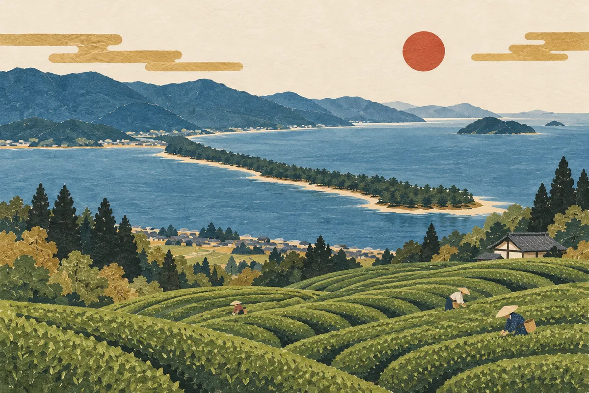
Amanohashidate, a scenic spot on the Sea of Japan
Amanohashidate, one of the Three Views of Japan, is in Miyazu City in northern Kyoto Prefecture.
Tea culture rooted in Uji
Uji is known as one of Japan's leading tea-growing areas, and Uji tea underpins Kyoto's food culture.
The priest Myōe Shōnin is said to have brought tea to Uji in the Kamakura period.
Kyoto sweets nurtured by water
The long presence of the imperial court, the gathering of fine ingredients, and abundant groundwater all supported the development of kyōgashi, Kyoto's traditional confectionery.
A prefecture long and narrow from north to south
The prefecture borders the Sea of Japan and Fukui Prefecture to the north, Osaka and Nara prefectures to the south, Mie and Shiga prefectures to the east, and Hyōgo Prefecture to the west. It is long and narrow from north to south, and the Tanba Highlands in the middle divide its climate: the north has a Sea of Japan–type climate and the south an inland climate.
The coast of the Tango and Chūtan regions in the north is a ria coast, with scenic spots and natural harbors. Most of the middle of the prefecture is mountainous; from the Tanba Highlands, water divides into the Katsura River and Yura River systems, and small basins such as the Kameoka and Fukuchiyama basins are scattered about. In the south, the Katsura, Uji, and Kizu rivers meet, and the Yamashiro Basin spreads out.
The abundance of mountains shows in the numbers too. The prefecture's forest ratio is 74.2% (2020), above the national average of 66.4%.
26 municipalities: which is the largest?
The prefecture has 26 municipalities: 15 cities, 10 towns, and 1 village. The prefecture covers 4,612.21 km² (as of October 1, 2024), of which Kyoto City is the largest at 827.83 km².
After Kyoto City, the largest are Nantan City in the central part of the prefecture and Fukuchiyama City in the north. Nantan City's forest ratio is 87.9%, the highest in the prefecture. At the other end, the smallest city is Mukō City at 7.72 km², and including towns and villages, the smallest is Ōyamazaki Town at 5.97 km². Large municipalities are mostly in the mountainous north and center, while small cities and towns are clustered south of Kyoto City.
Largest municipalities in Kyoto Prefecture by area (top 8)
- Kyoto City
- Nantan City
- Fukuchiyama City
- Kyōtango City
- Ayabe City
- Maizuru City
- Kyōtamba Town
- Kameoka City
A closer look at Amanohashidate and Uji tea
Amanohashidate is a sandbar 3.6 km long, made up of Ōhashidate, Kohashidate, and Daini Kohashidate. About 5,000 pine trees with trunks 10 cm or more in diameter line it, and in November 1952 it was designated a Special Place of Scenic Beauty under the Law for the Protection of Cultural Properties. On the sandbar are Amanohashidate Shrine and Iso-shimizu, a spring listed among Japan's 100 Best Waters.
As for Uji tea in the south, Kyoto Prefecture is seeking World Cultural Heritage inscription for "the Cultural Landscape of Uji Tea" in the Yamashiro region. The Yamashiro region is regarded as the "home of Japanese tea," where tea brought from China was cultivated and technical innovations gave rise to matcha, sencha, and gyokuro; the component sites cover 18 districts in 8 municipalities (as of March 2026).
The sandbars that make up Amanohashidate
| Section | Length | Area |
|---|---|---|
| Ōhashidate | 2,410 m | 18.8 ha |
| Kohashidate | 830 m | 4.9 ha |
| Daini Kohashidate | 410 m | 0.9 ha |
Mini quiz for this entry
Check what you've read with 3 multiple-choice questions.
Which Kyoto city is home to Amanohashidate?
Which drink is Uji famous for?
Who is said to have brought tea to Uji in the Kamakura period?
Sources and verification
Content checked: October 11, 2026
Updated: October 11, 2026
References are in Japanese.