
Japanese一口(いもあらい)
Imoarai
Other spellings and namesHigashi-imoarai (東一口) / Nishi-imoarai (西一口) / Imoarai Village / 一口
In short
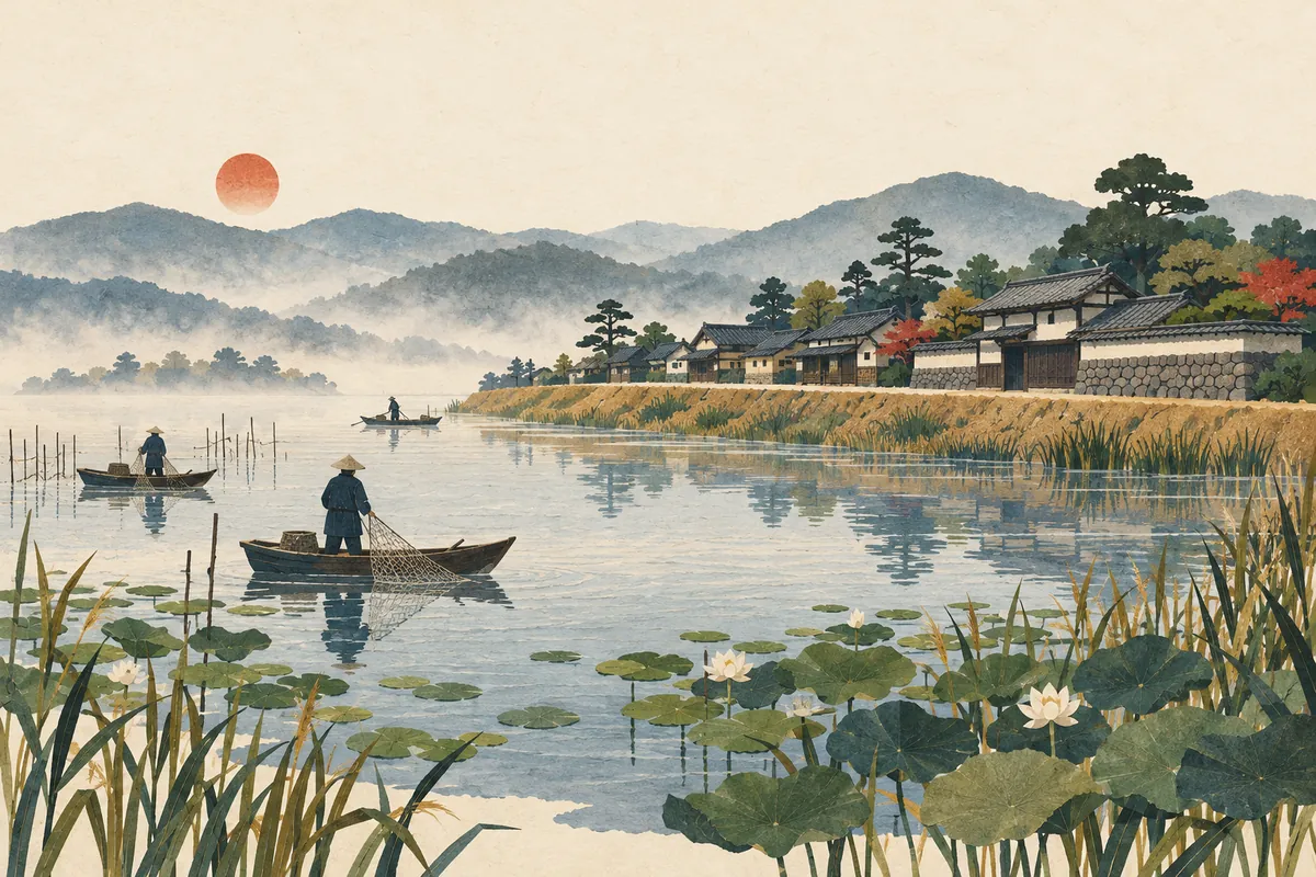
一口 is read Imoarai and survives as a place name in Higashi-imoarai and Nishi-imoarai in Kumiyama Town. Higashi-imoarai was a fishing settlement built on an embankment at the southwest of Ogura Pond (Oguraike), and the name is said to come from the pond's outlet to the Yodo River. However, there are several theories about why it is read Imoarai, and none is considered conclusive.Key points in 30 seconds
東一口 is read Higashi-imoarai and 西一口 is read Nishi-imoarai
Said to be a fishing settlement built on the Taikō Embankment at the southwest of Ogura Pond
The name is said to come from the pond's outlet to the Yodo River; there are several theories for the reading
Ogura Pond disappeared through reclamation in 1933–1941, and farmland now spreads over the area
Imoarai, not Hitokuchi
In Kumiyama Town, 東一口 is read Higashi-imoarai (ひがしいもあらい) and 西一口 is read Nishi-imoarai (にしいもあらい). Looking only at the kanji, you might want to read 一口 as hitokuchi ("one mouthful"), but as a place name it is Imoarai. The name is also used for local events, such as the Higashi-imoarai Tondo, a registered intangible folk cultural property of Kyoto Prefecture.
In Higashi-imoarai, every year on January 15, the three shrine guilds (miyaza) known as Hontōza, Gohei-za, and Ohashi-za hold a tondo bonfire together, and similar events are held in Nishi-imoarai and elsewhere. Note that the Kyoto Keihan Bus stop name is written 東いもあらい, partly in hiragana.
A fishing village that lived with Ogura Pond
Higashi-imoarai was a settlement that made its living from fishing on the shores of Ogura Pond. Embankments built in the Toyotomi era divided the pond into several ponds, and only Higashi-imoarai Village and two other towns and villages could fish in the Ōike (Great Pond), which made up 80% of the total. Higashi-imoarai Village in particular held privileged fishing rights granted in the time of Retired Emperor Toba, and it occupied 70% of the Ōike.
Higashi-imoarai is a fishing settlement that formed in a long strip on top of an embankment at the southwest of the former Ogura Pond. This embankment has been identified as the one built on Toyotomi Hideyoshi's orders, now called the Taikō Embankment (Taikō-zutsumi).
Higashi-imoarai was a village of part-time farmers and fishers, and it lived mainly by fishing until reclamation work on Ogura Pond began in 1933 (Shōwa 8). The fishing rights were managed by the Yamada family, the village's head officials (ōjōya), who represented the fishers of the Yodo River and Ogura Pond and led the 13 villages of Makishima-gō.
Why is 一口 read Imoarai? Several theories
The place name 一口 (literally "one mouth") is said to come from its being the only outlet from Ogura Pond to the Yodo River. In the Meiji-era improvement works on the Yodo River, the "Ogura Pond drainage channel from Higashi-imoarai" was abandoned, which suggests that Higashi-imoarai was where the pond's water flowed out.
On the other hand, there are several theories about why it is read Imoarai, and none is considered conclusive. The main ones are as follows.
Higashi-imoarai stood at the "outlet" of Ogura Pond
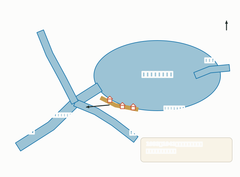
- Imi-harai theory: epidemics spread in the marshlands around Ogura Pond, and imi-harai (忌み祓い, "warding off misfortune") changed into imoarai
- Imo-arai theory: because this was the only waterway from Ogura Pond to the Yodo River, people washed mud off taro (imo-arai, 芋洗い, "washing taro") there
- The idea that imoarai was originally a word describing the landform, and that simply writing 一口 came to be read imoarai
Until Ogura Pond disappeared
Ogura Pond was a retarding basin formed in the area where the Katsura, Kizu, and Uji rivers meet to become the Yodo River. It was a shallow pond about 16 km around, with an area of 794 ha, and 90% of it was less than 1 m deep. The changes in Higashi-imoarai and Ogura Pond can be summarized as follows.
Changes in Ogura Pond and Higashi-imoarai
| Period | Event |
|---|---|
| Time of Retired Emperor Toba | Higashi-imoarai Village is said to have been granted privileged fishing rights |
| Toyotomi era | Embankments built to protect Fushimi Castle and the shores from floods divide Ogura Pond into several ponds. Higashi-imoarai is considered a settlement on top of this Taikō Embankment |
| 1900–1903 | Yodo River improvement works abandon the old Uji River and the Ogura Pond drainage channel from Higashi-imoarai |
| 1907 (Meiji 40) | Completion of the Uji River improvement fully separates river and pond, and the pond's water level drops |
| 1933–1941 (Shōwa 8–16) | National reclamation project drains the pond, creating 634 ha of rice paddies |
| 2010 (Heisei 22) | The former Yamada family residence in Higashi-imoarai (main house, nagaya gate, and long wall) becomes a Registered Tangible Cultural Property of Japan |
Where to see it today, and walking tips
The first place to visit is the former Yamada family residence in Higashi-imoarai. Built on a stone foundation wall in preparation for floods, it is estimated to date from the late 18th to the early 19th century. As of October 2026, it is open to the public on Saturdays, Sundays, and holidays from 9 a.m. to noon, with an admission fee of 200 yen. From Keihan Chūshojima Station, take a Kyoto Keihan Bus bound for Kintetsu Ōkubo, get off at Higashi-imoarai, and walk about 10 minutes.
The nearby Maekawa River is the main drainage channel for the former Ogura Pond. Both banks of the Maekawa embankment are lined with more than 200 cherry trees planted after the reclamation, and the blossoms are usually at their best from late March to early April. Comparing the wide rice fields with the settlement on top of the embankment, you can really feel that this was once the shore of a pond.
Mini quiz for this entry
Check what you've read with 2 multiple-choice questions.
How is the Kumiyama place name 東一口 read?
Higashi-imoarai (東一口) was once a settlement that prospered from fishing on which pond?
Sources and verification
Content checked: October 11, 2026
Updated: October 11, 2026
References are in Japanese.