
Japanese京都の田の字エリア(たのじエリア)
Kyoto's Ta-no-ji Area
Other spellings and namesTa-no-ji district (田の字地区) / Tanoji area / Central Kyoto (都心部) / Anko area
In short
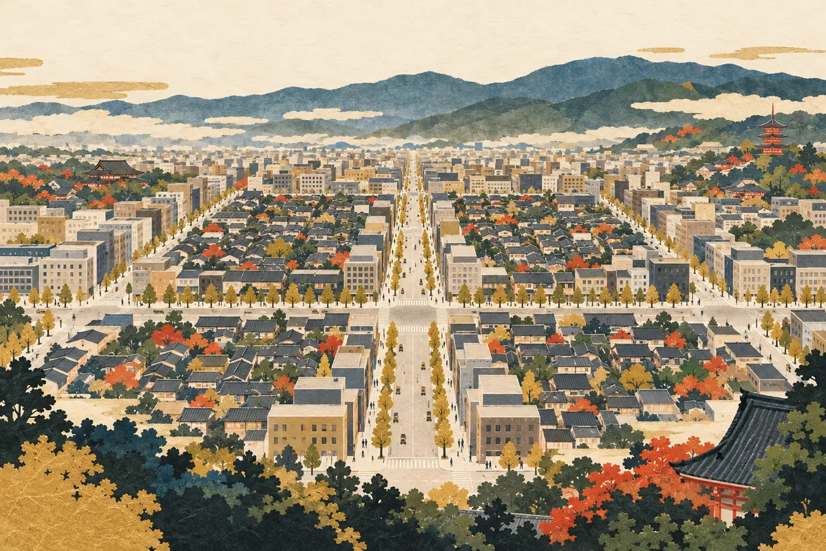
The Ta-no-ji area of central Kyoto is a name for the district bounded by Oike-dōri to the north, Gojō-dōri to the south, Kawaramachi-dōri to the east, and Horikawa-dōri to the west. Add Karasuma-dōri and Shijō-dōri, which run through the middle, and the streets form the shape of the kanji 田 (ta, "rice field"), a square divided into four, on the map.Key points in 30 seconds
North: Oike-dōri; south: Gojō-dōri
East: Kawaramachi-dōri; west: Horikawa-dōri
Karasuma-dōri and Shijō-dōri form the cross inside the 田
In city planning, the inner blocks are called the anko (the "bean-paste filling")
Grasping the Area Through Four Streets
The Ta-no-ji area refers to the district bounded by Oike-dōri and Gojō-dōri and by Kawaramachi-dōri and Horikawa-dōri, and it is regarded as the center of business, tourism, and daily life. It is not an official division like a ward; it is a way of describing the extent of the city center by street names.
Add Karasuma-dōri and Shijō-dōri, which run through the middle, to the four outer streets, and a shape resembling the kanji 田 appears on the map. That shape gives the area its name: ta-no-ji means "the character 田."
The Six Streets That Form the Ta-no-ji Area
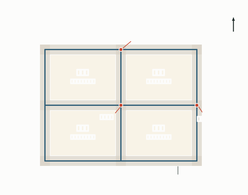
The six streets that form the 田 shape
| Position | Street | Direction |
|---|---|---|
| North side | Oike-dōri | East–west |
| Middle horizontal line | Shijō-dōri | East–west |
| South side | Gojō-dōri | East–west |
| East side | Kawaramachi-dōri | North–south |
| Middle vertical line | Karasuma-dōri | North–south |
| West side | Horikawa-dōri | North–south |
"Ta-no-ji" and "Anko" in City Planning
In the city's urban planning, the frontage along these six arterial roads is the "ta-no-ji" part. The area inside, enclosed by the arterial roads (east–west: Oike-dōri, partly Ebisugawa-dōri, Shijō-dōri, and Gojō-dōri; north–south: Kawaramachi-dōri, Karasuma-dōri, and Horikawa-dōri), where the floor-area ratio is capped at 400%, is the so-called anko, the "bean-paste filling" of the ta-no-ji.
In other words, the bands of large buildings along the streets are the lines of the 田, and the neighborhoods inside them are the anko. The anko, designated as a mixed residential and business district, covers about 152 hectares. In April 1998 the city drew up a guide plan for improving this mixed residential and business district and positioned it as an area leading the revitalization of the city center.
The ta-no-ji part and the anko part
| Along the arterial roads (the ta-no-ji part) | Mixed residential and business district (the anko part) | |
|---|---|---|
| Location | Blocks facing the six arterial roads | The inner area enclosed by the blocks along the arterial roads |
| Floor-area ratio | 700% (as of 2002) | Capped at 400% |
| Area | 218 ha (as of 2002) | 129 ha (2002) → about 152 ha (after the 2004 expansion) |
Buildings Along the Streets, Townhouses and Daily Life Inside
As of 2002, the districts along the arterial roads were commercial zones with a 700% floor-area ratio and a 45-meter height limit, and shops, offices, and similar uses made up most of the buildings over 20 meters tall. Meanwhile, in the draft of its 2011 urban planning master plan, Kyoto City set out a policy of carrying on, in the anko, a streetscape centered on low- and mid-rise buildings with well-aligned frontages.
In April 2003, Kyoto City put into effect a building ordinance for the special mixed residential and business use district, which requires, among other things, that apartment buildings exceeding a 300% floor-area ratio include non-residential facilities on the third floor or below. In December 2004 the district was expanded to take account of ryōgawa-machi ("two-sided towns") streetscapes, in which the houses facing each other across a street form a single town.
With the introduction of Kyoto's new landscape policy in 2007, the height limit in the mixed residential and business district was revised from 31 meters to 15 meters. A defining feature of the Ta-no-ji area is that building heights are deliberately treated differently on the street frontage and in the interior.
The Boundaries Vary Slightly Depending on Who Is Explaining
In tourist information, the Ta-no-ji area generally means the whole area enclosed by the four outer streets. In the city's urban planning, however, "ta-no-ji" refers to the frontage along the six arterial roads, and the inside is distinguished as the anko. The same term can therefore mean either the broad area including the street frontage or just the lines themselves.
The boundaries also do not follow the street lines exactly. The mixed residential and business district excludes the 700% floor-area-ratio frontage along the arterial roads, and north of Oike-dōri, between Kawaramachi-dōri and Karasuma-dōri, it extends as far as Ebisugawa-dōri. When checking the area on a map, it is reassuring to confirm which sense of the lines is meant.
Reading Central Kyoto Through Street Names
In Kyoto there is a culture of describing locations by intersections and street names. The Ta-no-ji area, too, is a very Kyoto way of understanding space, with its boundaries in each direction marked by streets. If you memorize the names of the intersections where the lines of the 田 cross, such as Karasuma-Oike, Shijō-Karasuma, and Shijō-Kawaramachi, the map of the city center becomes much easier to read.
Each of the six streets has its own character. Oike-dōri has Kyoto City Hall and Nijō Castle, and Karasuma-Oike is a place where people gather. Karasuma-dōri, with the Karasuma subway line running beneath it, is a major business artery; Shijō-dōri from Shijō-Kawaramachi to Shijō-Karasuma is a shopping and entertainment district, and the Gion Festival floats also pass along Shijō-dōri.
If you walk here, try turning off the lines of the 田 into a street one block inside, centering on the Shijō-Karasuma intersection; you will easily sense the difference between the office buildings along the main streets and the houses of the neighborhoods. The order of the east–west streets is covered in the entry on street-name songs, and the history of the north–south streets in entries such as "The History of Higashiōji-dōri and Horikawa-dōri."
Mini quiz for this entry
Check what you've read with 1 multiple-choice questions.
Which four streets bound central Kyoto's so-called Ta-no-ji area?
Sources and verification
Content checked: October 11, 2026
Updated: October 11, 2026
References are in Japanese.