
Japanese上終町(かみはてちょう)
Kamihate-chō
Other spellings and namesKitashirakawa-Kamihate-chō / 北白川上終町
Key points
The town name is read Kitashirakawa-Kamihate-chō (きたしらかわかみはてちょう): 上 is kami and 終 is hate
In the school zone of Kitashirakawa Elementary School and Konoe Junior High School (as of April 2025)
The bus stop on Shirakawa-dōri is Kamihate-chō / Uryūyama Gakuen Kyoto University of the Arts-mae
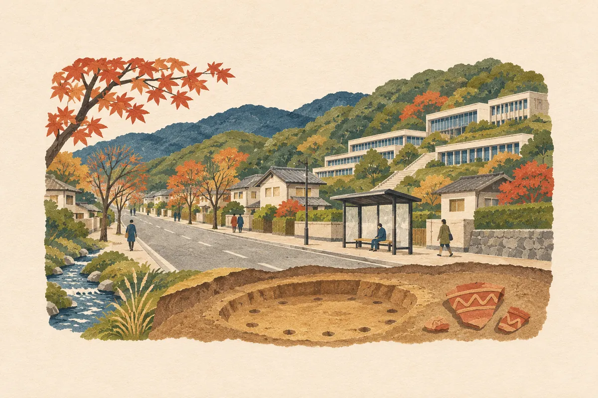
An Early Jōmon pit dwelling from about 8,000 years ago was found at the Kamihate-chō site
A town name that reads 終 as hate
上終町 is read Kamihate-chō (かみはてちょう). In addresses it carries the prefix Kitashirakawa and is written 北白川上終町 (Kitashirakawa-Kamihate-chō), and it is in the school zone of Kitashirakawa Elementary School and Konoe Junior High School (as of April 2025). Kitashirakawa has other town names that read 上 as kami, such as 上池田町 (Kamiikeda-chō) and 上別当町 (Kamibettō-chō).
The hard character is 終. The kun readings usually given for 終 are owaru, oeru, and tsui, and hate is not a common reading. Hate is a word normally written 果て, meaning the end of something or its very farthest edge.
The bus stop name uses the same reading: 上終町・瓜生山学園 京都芸術大学前 is read Kamihate-chō / Uryūyama Gakuen Kyōto Geijutsu Daigaku-mae (かみはてちょう・うりゅうやまがくえん きょうとげいじゅつだいがくまえ).
On Shirakawa-dōri in Kitashirakawa, near Kyoto University of the Arts
Kitashirakawa spreads out at the southwestern foot of Mount Hiei, on an alluvial fan formed by the Shirakawa River. Shirakawa-dōri runs north–south through it, and the Shigagoe-michi (Yamanaka-goe), which once linked Kyoto with Ōmi, still remains as a main east–west road.
Kamihate-chō is a town along Shirakawa-dōri. On Shirakawa-dōri there is a city bus and Kyoto Bus stop named Kamihate-chō / Uryūyama Gakuen Kyoto University of the Arts-mae, served by city bus route 3 and others. On route 3, only the buses bound for Kitashirakawa-Shibuse-chō with "Kamihate-chō / Uryūyama Gakuen Kyoto University of the Arts-mae" added to the destination stop here, after looping through Kitashirakawa-Shibuse-chō (as of November 2026). Kyoto University of the Arts (address: Kitashirakawa Uryūyama) is on the east side of the street, and Chayama–Kyoto University of the Arts Station on the Eizan Electric Railway is to the west, about a 10-minute walk from the university.
On guide maps from the days when the university was called Kyoto University of Art and Design, the stop appears as Kamihate-chō Kyōto Zōkei Geidai-mae.
The Kamihate-chō site and Jōmon-period Kitashirakawa
Kitashirakawa has many Jōmon-period sites, and the Kamihate-chō (かみはてちょう) site is one of the best known. A 1991 excavation found an Early Jōmon (about 8,000 years ago) pit dwelling and fragments of oshigatamon pottery (おしがたもんどき), decorated by rolling a carved stick over the clay to leave chevron or diagonal lattice patterns. It is considered the oldest pit dwelling in the Kyoto basin.
The Jōmon sites in this area extend as far as Okazaki and are known together as the Kitashirakawa Jōmon site group. Kitashirakawa is also home to the Kitashirakawa temple ruins, where the remains of an Asuka-period pagoda and other structures were found, and the ruins of the Sengoku-period Kitashirakawa Castle near the summit of Mount Uryū.
The origin of the name is unclear
The origin of the town name Kamihate is not clear.
The Kitashirakawa area corresponds to Kami-Awata-gō, a district that appears in the Heian-period dictionary Wamyōshō, and a settlement is thought to have existed by around 1391 (Meitoku 2). The area north of the Shirakawa River is said to have been called Kitashirakawa ("north Shirakawa") and the area south of it Minamishirakawa ("south Shirakawa"). Through the former Shirakawa Village, the Shirakawa River flows from east to southwest along the Yamanaka-goe (Shigagoe-michi).
Mini quiz for this entry
The area north of the Shirakawa River was called Kitashirakawa. What is the area south of it said to have been called?
Sources and verification
Content checked: November 8, 2026
Updated: November 8, 2026
References are in Japanese.