
Japanese樫原(かたぎはら)
Katagihara
Other spellings and namesKatagihara-juku / 樫原宿
Key points
Both the town names and the elementary and junior high schools are read Katagihara
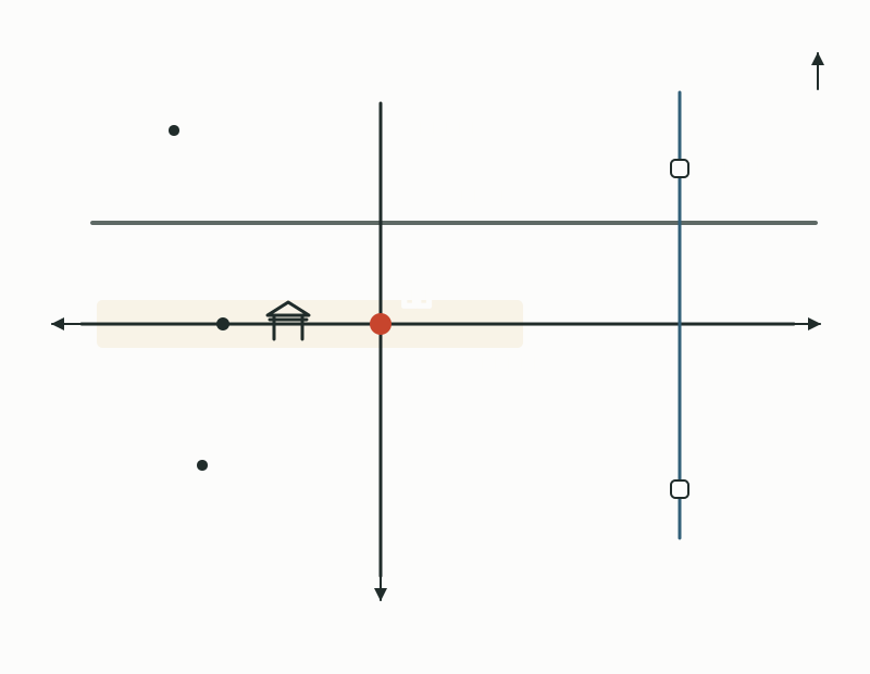
The old San'in Kaidō runs east–west and the Mozume Kaidō north–south, and the center is near where they cross
The Katagihara Honjin (Tamamura family residence) was designated a Tangible Cultural Property of Kyoto City in 1992 (Heisei 4)
About 6 minutes by city bus from Hankyu Katsura Station, or about 15 minutes on foot
47 town names read Katagihara
樫原 is read Katagihara (かたぎはら). 樫 is usually read kashi ("oak"), so it is tempting to read the name Kashihara. Nishikyō Ward has 47 town names beginning with 樫原, such as 樫原池ノ上町 (Katagihara-Ikenoue-chō, かたぎはらいけのうえちょう) and 樫原下ノ町 (Katagihara-Shimonochō, かたぎはらしものちょう), and all of them are in the school zone of Katagihara Elementary School and Katagihara Junior High School (as of April 2025).
Some town names end in chō (町) and some do not, and in some the latter part is hard to read too, as in 樫原釘貫 (Katagihara-Kuginuki, くぎぬき), 樫原百々ケ池 (Katagihara-Dodogaike, どどがいけ), 樫原硲町 (Katagihara-Hagama-chō, はがまちょう), and 樫原蛸田町 (Katagihara-Takoden-chō, たこでんちょう).
West of Katsura Station, where two old roads meet
Katagihara is on the right bank of the Katsura River, west of Hankyu Katsura Station. The old San'in Kaidō, which linked Kyoto with Tanba and the San'in region, runs east–west, and the Mozume Kaidō runs north–south; the area where the two cross is the center of Katagihara. The Mozume Kaidō is a road linking the San'in Kaidō and the Saigoku Kaidō, and it meets the San'in Kaidō at Katagihara. The old San'in Kaidō is the road that led from Shichijō-dōri through Katsura and Katagihara to Oinosaka, following nearly the same route as today's National Route 9.
From Hankyu Katsura Station it takes about 6 minutes by city bus route 33 and others, or about 15 minutes on foot; from JR Katsuragawa Station it takes about 11 minutes by city bus route 69 and others (as of November 2023). The nearest bus stops are Katagihara, Kōkaidō-mae, and Sannomiya, and the Katagihara Honjin is right by the Kōkaidō-mae stop. Hankyu's Rakusaiguchi Station lies to the southeast of Katagihara.
The two old roads of Katagihara and nearby stations
Where the name comes from
In Japanese dictionaries, kashihara (樫原) is a word for a field thickly overgrown with oak trees, and katagi (堅木) is a word for trees that yield hard timber, such as oaks, sawtooth oak, konara oak, and zelkova. However, no record could be confirmed showing that the place name Katagihara comes from these words, and its origin is unclear. Katagihara Sannomiya Shrine is said to have once also been called Kashiwara Shrine.
The remains of a temple from the mid-7th century were named the Katagihara Temple Site (Katagihara Haiji) after the place name, because the temple's name is unknown, and they became a national Historic Site in 1971 (Shōwa 46).
The first post town out of Kyoto, and the Katagihara Honjin
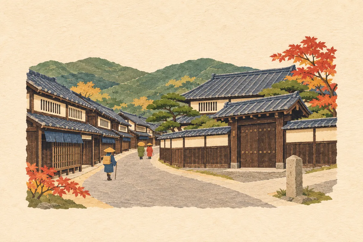
In the Edo period, Katagihara thrived as the first post town on the San'in Kaidō after leaving Kyoto, and it was also a place where goods carried from Tanba and Tango were gathered. A story remains of how botamochi (sweet rice cakes) meant for the house across the street went bad because a daimyo procession kept people from crossing the road.
The Katagihara Honjin (Katagihara-Shimonochō) at the heart of the post town is the residence of the Tamamura family. It was an inn where only a limited few stayed, such as daimyo traveling for sankin kōtai (alternate attendance). Because the honjin of the Fushimi post town does not survive, this is the only remaining honjin in Kyoto City, and it was designated a Tangible Cultural Property of Kyoto City in 1992 (Heisei 4). Nearby Muryō-in is a temple that served as the waki-honjin (secondary inn) during daimyo processions.
Along the old road, machiya townhouses with mushiko lattice windows (むしこまど) set into the walls of their low second floors still stand side by side in large numbers. The area is Kyoto City's Nishikyō Katagihara Kaiwai Landscape Improvement District, and in October 2020 (Reiwa 2) about 7.1 hectares were designated the Nishikyō Katagihara Kyō-machiya Preservation and Succession District.
Akechi Mitsuhide's road and a late-Edo stone marker
In 1575 (Tenshō 3), Akechi Mitsuhide, on his way to subdue Tanba, is said to have used Katagihara as a supply base and improved the road from Oinosaka through Katagihara to Katsura. He is also said to have built reservoirs and irrigation channels, and the Kobatake River (こばたけがわ) is also called the Akechi River.
On the 19th day of the 7th month of 1864 (Genji 1), three men fleeing after their defeat in the Kinmon Incident, a Chōshū samurai and two brothers said to be Satsuma samurai, were cut down at Katagihara by samurai of the Obama domain on the shogunate's side. Their grave, where the villagers buried them with care, is on a nearby hill, and at Katagihara-Ujii-chō, near where the two roads cross, stands a stone marker reading "Place Where Loyalists Met Their Deaths," erected in 1979 (Shōwa 54).
Mini quiz for this entry
At the Edo-period post town of Katagihara, which temple served as the waki-honjin (secondary inn) during daimyo processions for sankin kōtai?
Sources and verification
Content checked: November 8, 2026
Updated: November 8, 2026
References are in Japanese.
- 京都市教育委員会「京都市通学区町名一覧(西京区)」
- 京都市西京区役所「樫原まちあるきMAP」
- 京都市西京区役所「西京区の文化のはなし」
- 京都市「西京区・区民の誇りの木 エリアC」
- 京都市西京区役所「区民だより西京 No.193(平成24年1月15日)」
- 京都市告示「西京樫原京町家保全継承地区の指定」(令和2年10月30日)
- 京都市考古資料館 文化財講座 第306回「樫原廃寺」
- 京都市 いしぶみデータベース「NI001 勤王家殉難地」
- 京都観光Navi(京都市観光協会)「樫原まちあるきツアー」(樫原本陣の所在地とバス停)
- コトバンク「樫原(かしはら)」(精選版 日本国語大辞典)
- コトバンク「堅木」(デジタル大辞泉・精選版 日本国語大辞典)