
Preservation Districts for Groups of Traditional Buildings and the Okazaki Cultural Landscape
Key points
Two of the four are temple-gate towns, one a teahouse town and one a shrine-priest town; Kamigamo is the only shrine-priest town among Japan's Important Preservation Districts
Sannenzaka and Gion Shinbashi were already protected by city ordinance before the national system existed
All of the districts are lived-in towns: do not peer into houses or go through the gates and entrances of priests' residences and teahouses
Okazaki was selected for scenery in which temples, farmland, and cultural facilities have layered up around the canal
How the Jūdenken system works
The system of Preservation Districts for Groups of Traditional Buildings (denken districts) was created by the 1975 (Shōwa 50) amendment to the Law for the Protection of Cultural Properties. It protects townscapes where buildings survive as a group, such as castle towns and temple-gate towns. First the municipality defines a district through city planning and the like and draws up a preservation plan; then, on the municipality's application, the national government selects those of high value as "Important Preservation Districts for Groups of Traditional Buildings" (jūdenken). This is why they are "selected" rather than "designated" like National Treasures. There are 130 Important Preservation Districts nationwide (as of September 2026).
Kyoto City moved ahead of the national government: in 1972 it enacted the Urban Landscape Ordinance, Japan's first comprehensive townscape preservation measure, and in the same year designated the Sannenzaka area as one of its own "Special Preservation and Improvement Districts," followed by the Gion Shinbashi area in 1974. When the national system was created, the city made both areas preservation districts in 1976, and they were selected as Important Preservation Districts the same year. New construction and changes to building exteriors within a district require the city's permission, and subsidies are available for repairs and for "improvement" work that brings buildings into harmony with the townscape.
How the four districts differ
Locations of Kyoto City's Four Important Preservation Districts and the Cultural Landscape of Kyoto Okazaki (Schematic)
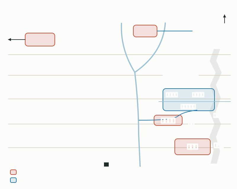
Kyoto City's four Important Preservation Districts for Groups of Traditional Buildings
| Name | Ward | Type | National selection | Area |
|---|---|---|---|---|
| Kyoto City Sannenzaka | Higashiyama | Temple-gate town | September 4, 1976 | About 8.2 ha |
| Kyoto City Gion Shinbashi | Higashiyama | Teahouse district | September 4, 1976 | About 1.4 ha |
| Kyoto City Saga Toriimoto | Ukyō | Temple-gate town | May 21, 1979 | About 2.6 ha |
| Kyoto City Kamigamo | Kita | Shrine-priest residential town | December 16, 1988 | About 2.7 ha |
- Sannenzaka (around Shimokawara-chō and Masuya-chō, Higashiyama Ward): it began as the temple-gate town of Kiyomizu-dera, Hōkan-ji, and the Gion shrine, and the town grew along the pilgrims' route from the mid-Edo period onward. The district covers the stone-stepped slopes of Sannenzaka (Sannei-zaka) and Ninenzaka, the area around the Yasaka Pagoda, the road from the front gate of Kōdai-ji to Maruyama Park, and Ishibe-kōji, with townhouses (machiya) mainly from the late Edo period to the Taishō era. About 65% of the buildings are traditional. The district was about 5.3 ha when selected and grew to about 8.2 ha in 1995 when the Ishibe-kōji area was added.
- Gion Shinbashi (around Motoyoshi-chō, Higashiyama Ward): opened in 1712 (Shōtoku 2) as a teahouse quarter of the six Gion neighborhoods, it flourished in connection with theater and the performing arts. Against the backdrop of the Shirakawa stream and stone paving, two-story teahouse-style townhouses line Shinbashi-dōri; of about 75 houses, about 70% are traditional buildings.
- Saga Toriimoto (Saga Toriimoto, Ukyō Ward): settled in the late Muromachi period as a farming and forestry village, it took on the character of a temple-gate town on the Atago pilgrimage road (Atago Kaidō) to Atago Shrine from the mid-Edo period. The district covers about 600 m along the road; with Adashino Nenbutsu-ji as the dividing point, the upper section near the first torii is mainly thatched farmhouse-style buildings, and the lower section mainly townhouse-style buildings with mushiko lattice windows. About 50% of the buildings are traditional.
- Kamigamo (around Kamigamo Fujinoki-chō, Kita Ward): along the Myōjin River, the name taken by the Nara-no-ogawa stream after it leaves the grounds of Kamigamo Shrine, a residential town of shrine priests (shashi and ujibito) formed from the Muromachi period. With its earthen bridges, earthen walls, gates, and gable-entry main houses of the priests' residences (shake), it is the only Important Preservation District in Japan classed as a shrine-priest residential town. About 63% of its 52 houses are traditional buildings.
Okazaki's "cultural landscape," which protects scenery
A cultural landscape is a cultural property that protects a landscape shaped by people's lives, livelihoods, and the local environment; the object of protection is the scenery itself rather than a group of buildings. On application from a local government, the national government selects "Important Cultural Landscapes," and in Kyoto City the Okazaki area, from the foot of the Higashiyama hills to the Kamo River, was selected on October 7, 2015. Of the 74 on the Agency for Cultural Affairs' list of Important Cultural Landscapes nationwide, it is the only one in the city.
In the late Heian period, Okazaki was the site of the Shirakawa-dono palace and the great temple complex of the Rokushō-ji; after the Ōnin War it became farmland on the edge of the city. When the Lake Biwa Canal opened in 1890 (Meiji 23), a factory zone using canal water and a cluster of villas with gardens by Ogawa Jihei VII (Ueji) and others on former Nanzen-ji temple land emerged, and in 1895 the Fourth National Industrial Exhibition and the 1,100th anniversary of the founding of the Heian capital led to the founding of Heian Shrine. The zoo (1903), the prefectural library (1909), and the city art museum (1933) followed. The reason for the selection is this layering of temples, farmland, and cultural and educational facilities around the axis of the canal.
Kyoto City's own landscape systems
In addition to the national Important Preservation Districts, Kyoto City designates its own districts under the Urban Landscape Improvement Ordinance enacted in 1995. "Historic Landscape Preservation and Improvement Districts," which protect the appearance of townscapes, number three: Gion-machi Minami, Gion Nawate and Shinmonzen, and Kamigyō Ogawa. "Neighborhood Landscape Improvement Districts," which shape lively areas with local character, number eight: Fushimi Minamihama, Sanjō-dōri, Kamigamo-gō, Kamigyō Kitano, Senryōgatsuji, Nishikyō Katagihara, Hongan-ji and Tō-ji, and Pontochō.
Access and etiquette for walking with a family
All of these districts are towns where people live. Do not peer into houses or take photos right in front of doorways, and explain to children that these are people's homes. There are many stone steps and stone pavements, and a baby carrier is often easier than a stroller.
- Sannenzaka: about 5 minutes on foot from the "Higashiyama Yasui" or "Gojōzaka" city bus stops. Kiyomizu-dera opens at 6:00 a.m., so early morning before the crowds is the easiest time to walk
- Gion Shinbashi: about 3 minutes on foot from Keihan Gion-Shijō Station. The stone paving along the Shirakawa is flat. Do not step into the entrances of the teahouses
- Saga Toriimoto: about 3 minutes on foot from the "Toriimoto" Kyoto Bus stop, or about 30 minutes from JR Saga-Arashiyama Station. The Kyoto City Saga Toriimoto Townscape Preservation Museum is free and shows an early Meiji townhouse and a model of the Atago road in the early Shōwa era. Adashino Nenbutsu-ji costs 500 yen for adults and is free for elementary school age and younger with a guardian
- Kamigamo: about 2 minutes on foot from the "Kamigamo-jinja-mae" city bus stop (route 4 from Kyoto Station). The path along the Myōjin River is flat and easy to walk. The priests' residences are private homes, so do not go through the gates
- Okazaki: about 8 minutes on foot from Higashiyama Station on the Tōzai subway line to the Kyoto City KYOCERA Museum of Art, or take the city bus to "Okazaki Kōen Bijutsukan Heian Jingū-mae." Okazaki Park and the canal-side paths are free to walk
Mini quiz for this entry
When the Sannenzaka Important Preservation District was enlarged in 1995, which area was added?
Okazaki has been selected as the national Important Cultural Landscape "Cultural Landscape of Kyoto Okazaki." Which great temple complex was built there in the late Heian period?
Sources and verification
Content checked: October 18, 2026
Updated: October 18, 2026
References are in Japanese.
- 文化庁「重要伝統的建造物群保存地区一覧」(令和8年9月1日現在)
- 文化庁「伝統的建造物群保存地区」
- 文化庁「重要伝統的建造物群保存地区 京都市産寧坂・祇園新橋・嵯峨鳥居本・上賀茂(京都市作成)」
- 京都市「伝統的建造物群保存地区」
- 京都市「産寧坂伝統的建造物群保存地区保存計画」
- 京都市「祇園新橋伝統的建造物群保存地区保存計画」
- 京都市「嵯峨鳥居本伝統的建造物群保存地区保存計画」
- 京都市「上賀茂伝統的建造物群保存地区保存計画」
- 京都市「上賀茂神社周辺エリア(協働版)」(歴史的資産周辺の景観プロファイル)
- 京都市「『歴史的町並みの保全再生』のふりかえり」(審議会参考資料)
- 京都市「京都市嵯峨鳥居本町並み保存館の運営について」(令和8年度)
- 文化庁「重要文化的景観一覧」
- 文化庁 文化遺産オンライン「京都岡崎の文化的景観」
- 京都市文化財保護課「京都岡崎の文化的景観」(重要文化的景観選定記念パンフレット)
- 京都市文化財保護課「京都市内文化財件数」(令和8年4月1日現在)
- 京都市観光協会「産寧坂伝統的建造物群保存地区」(京都観光Navi)
- 京都市観光協会「祇園新橋伝統的建造物群保存地区」(京都観光Navi)
- 京都市観光協会「嵯峨鳥居本伝統的建造物群保存地区」(京都観光Navi)
- 京都市観光協会「京都市嵯峨鳥居本町並み保存館」(京都観光Navi)
- 京都市観光協会「上賀茂伝統的建造物群保存地区」(京都観光Navi)
- 上賀茂神社「アクセス」
- 清水寺「アクセス・拝観時間」
- 化野念仏寺「拝観のご案内」
- 京都市京セラ美術館「アクセス」